
are a part of our industry, and also our history.
MINES
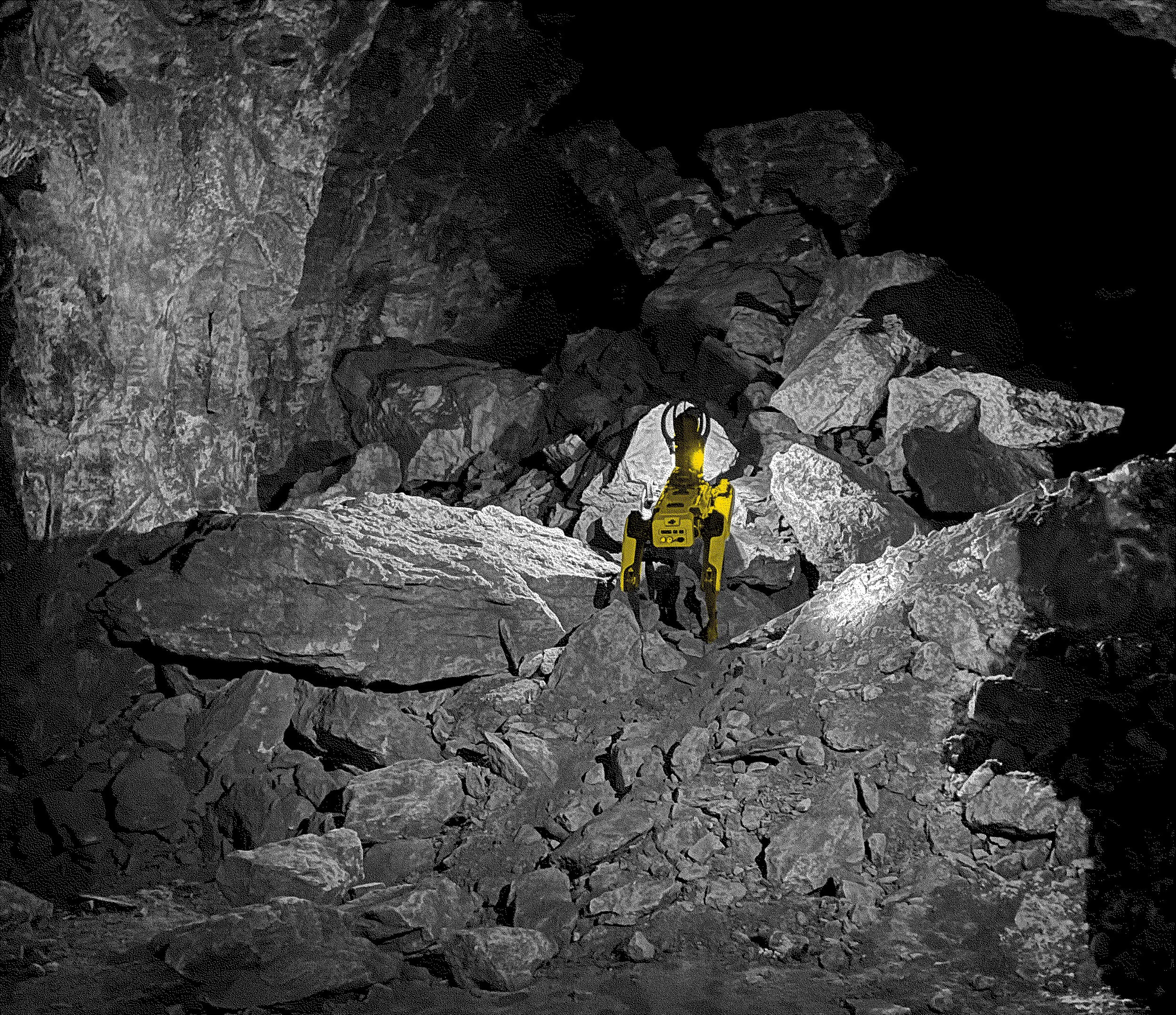
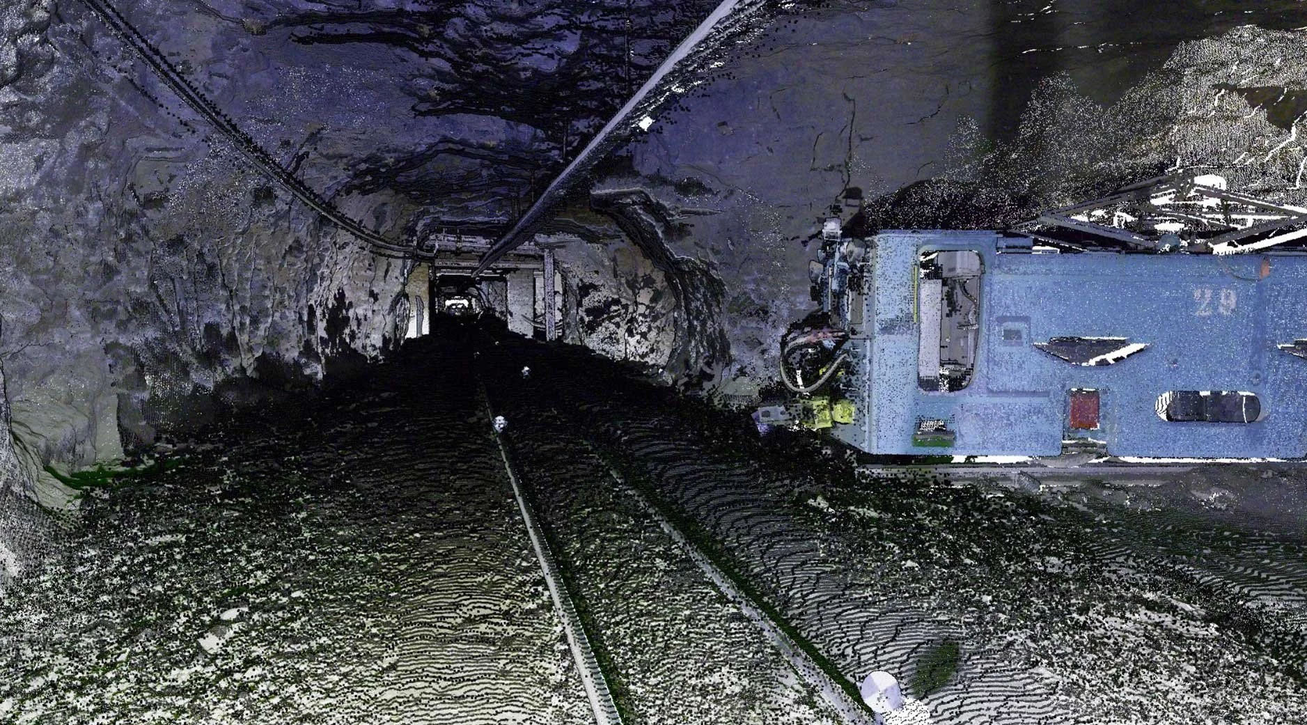
Exploring old mines is a complex and hazardous task that can put human lives at risk. The use of robots equipped with lidar (laser-based remote sensing) can greatly facilitate this task. Robots can be programmed to explore mines and collect real-time data with great precision, creating detailed maps of the inside of mines. This mapping is essential to assess collapse risks, identify unstable areas, and spot historical remnants or potential resources. Lidar-equipped robots are also faster and more efficient than humans, reducing labor costs and increasing operational safety.
In summary, sending a robot equipped with lidar to map old mines is an effective and safe solution for exploring and managing these complex sites.
How it works
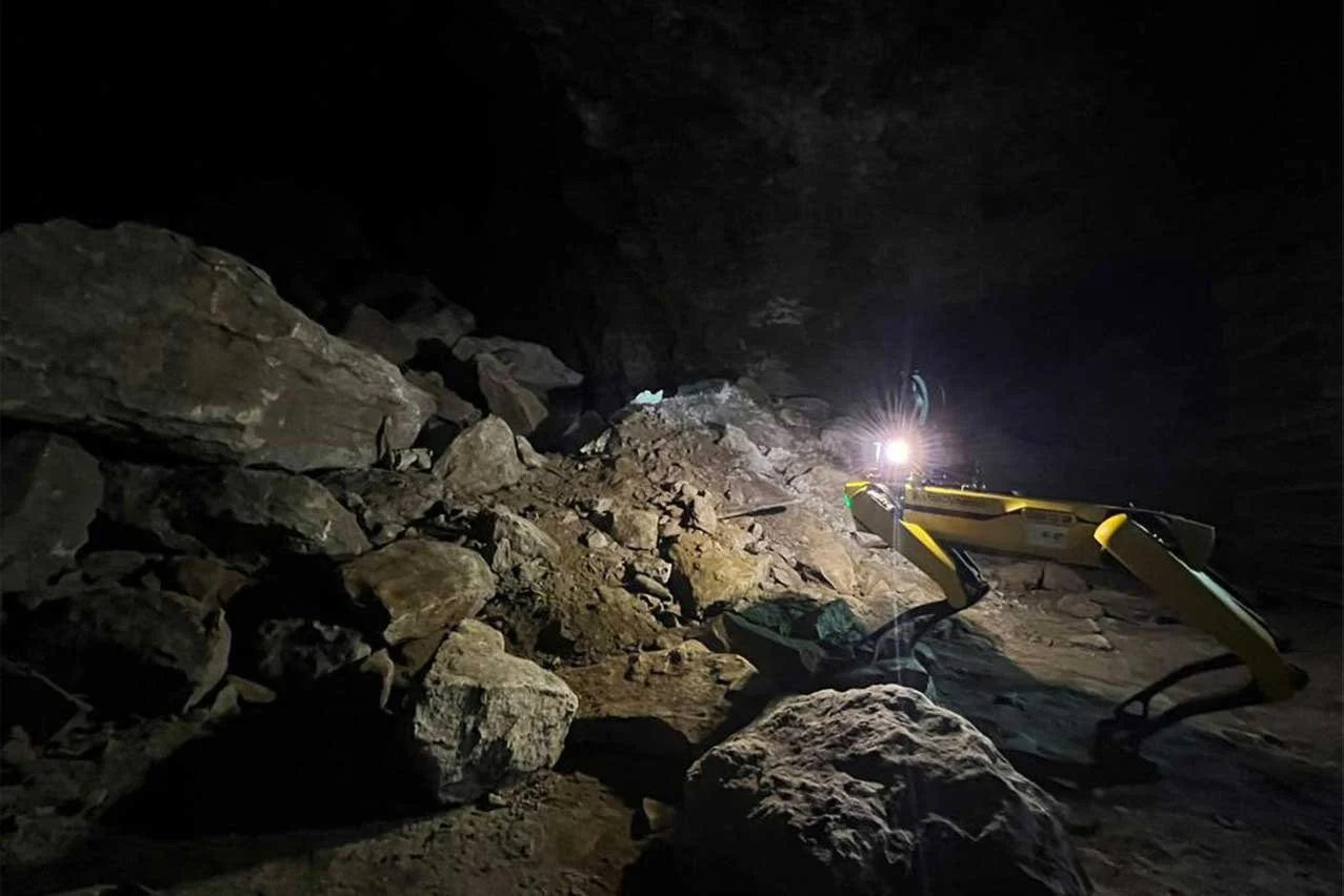
Our scanning technology (here our great robot dog) follows a specific path through the tunnels even with uneven terrain, to capture exhaustive, precise and quantifiable information of all the mine.
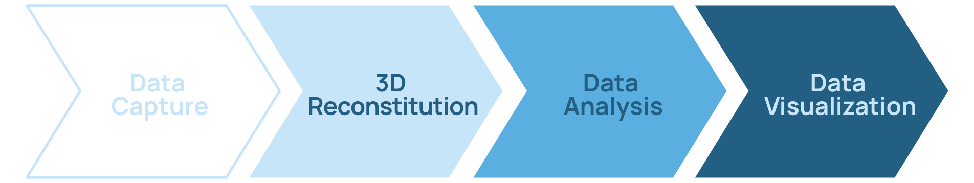
Data Capture
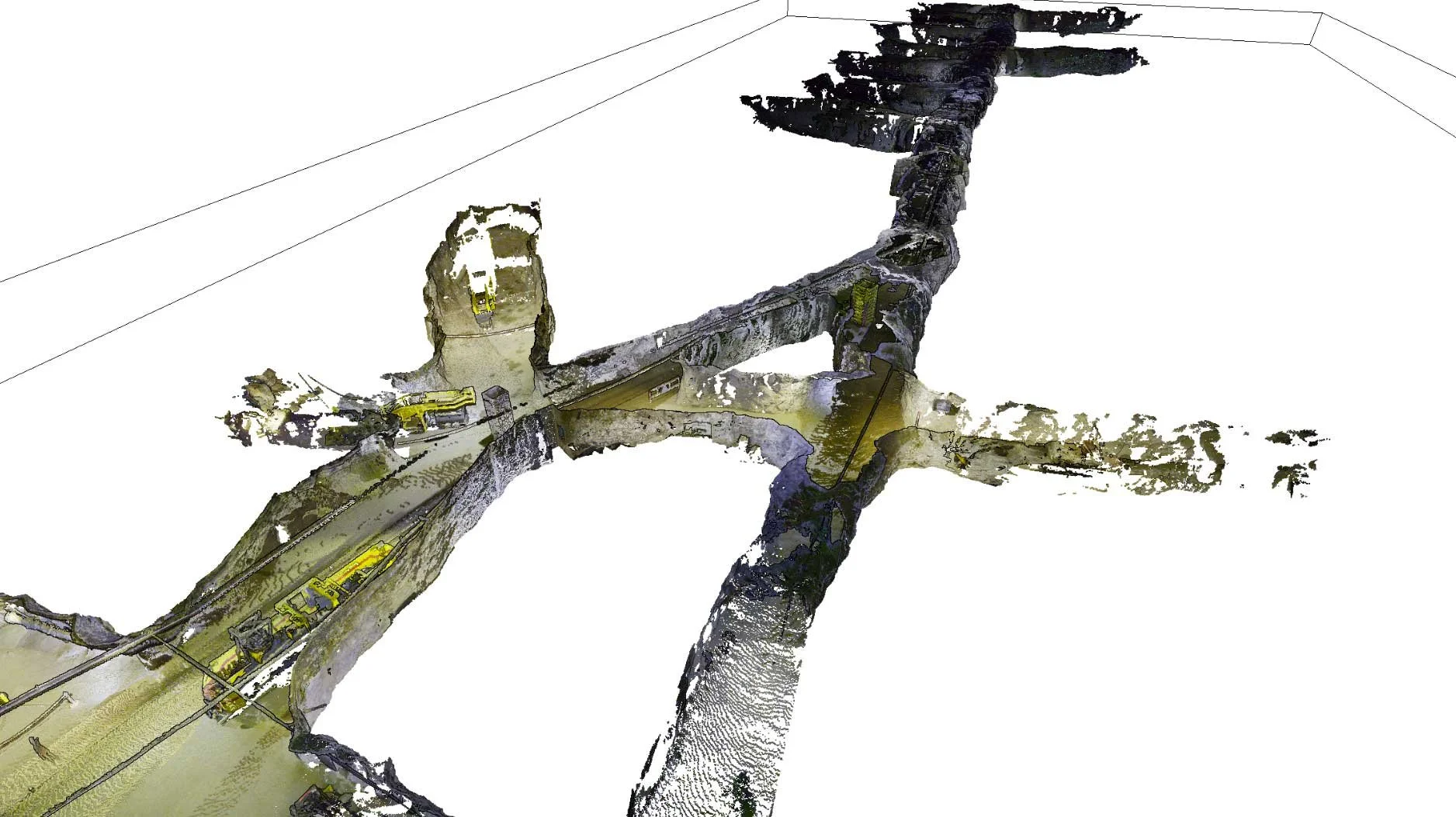
All scanned data is assembled to create a 3D visual environment as an accurate replica of the actual mine.
3D Reconstitution
Our proprietary technology allows us to develop a specific analysis bringing precise and useful information on the mine's condition such as cavities' description or galleries' stability.
Data Analysis
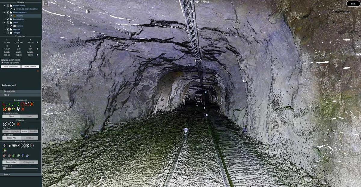
Our platform allows the experts to navigate in the 4D twin and even go back in time to analyse differences through different data capture periods.